
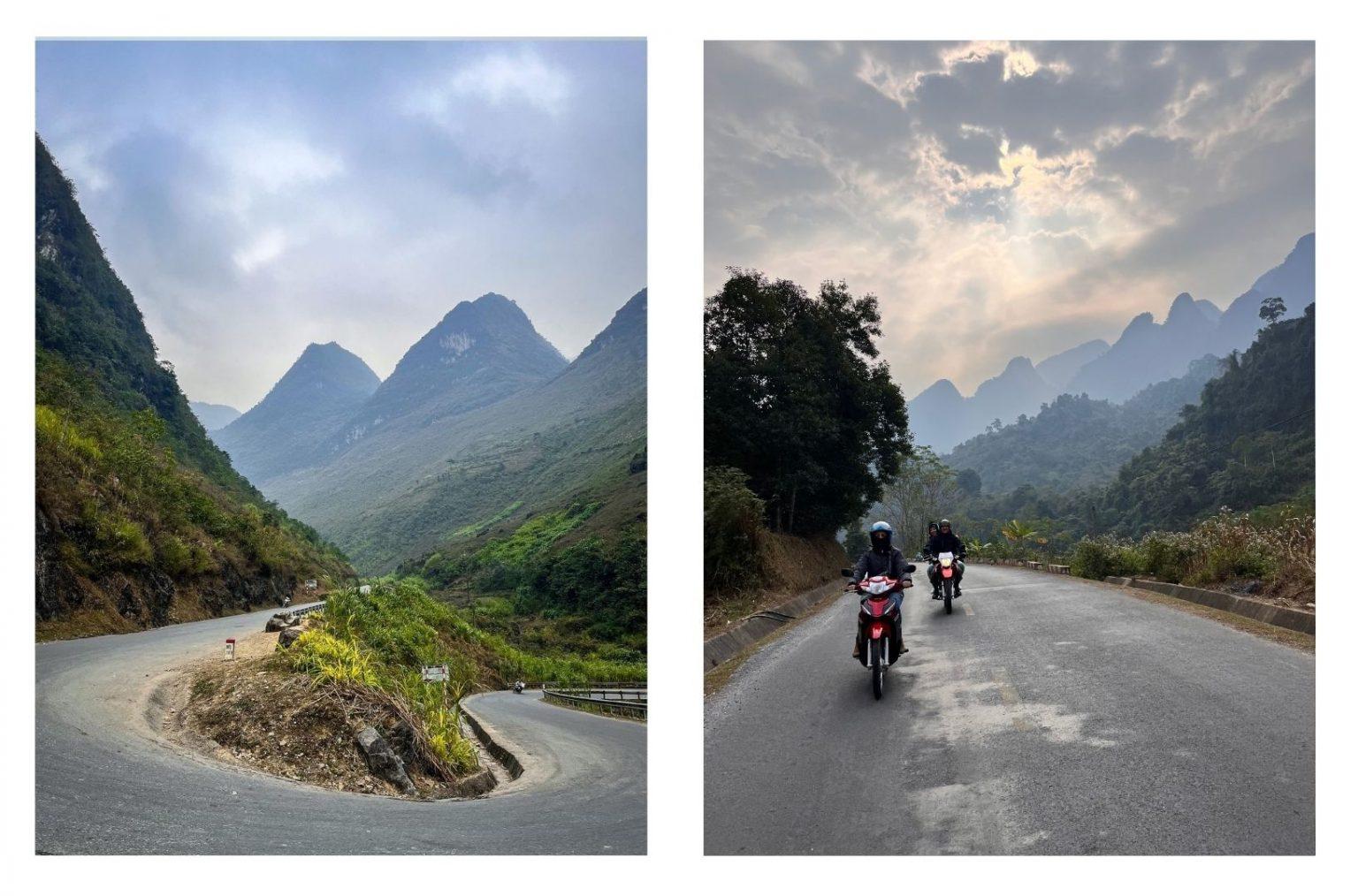
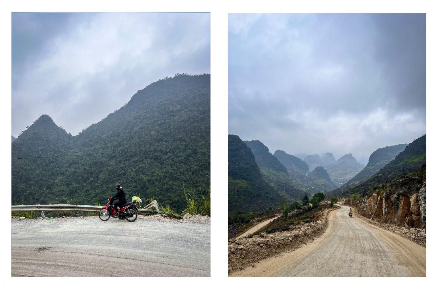
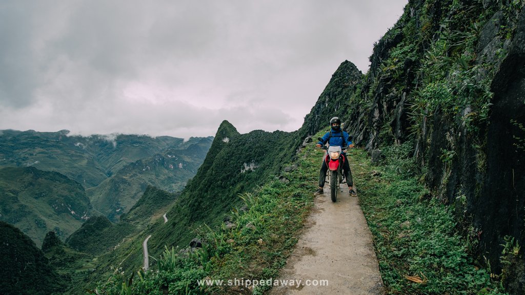
We have come up with a route to make our trip to Vietnam unique, and even before going, we couldn’t contain our excitement for the Ha Giang Loop. Ha Giang Loop is not only Vietnam’s most special motorcycle route, but it is also one of the world’s renowned and challenging routes.
We were unaware that there was a motorcycle route in Vietnam. When planning our New Year’s trip to Vietnam, a few of our friends suggested that since we were embarking on a long journey, we should extend our stay a bit longer. They requested us to come up with a different route in Vietnam. So we started researching if we could find a unique route in Vietnam. After our research, we came across the most remarkable route, which is the Ha Giang Loop.
Where Is Ha Giang – What Is Ha Giang Loop
Ha Giang, located 320 km away from the capital city of Hanoi in northern Vietnam, is a region bordered by China. It is still home to ethnic minorities and is surrounded by mountains. Ha Giang, which hosts one of the world’s best motorcycle routes, showcases breathtaking landscapes with its passes, rivers, canyons, and diverse ethnic cultures that will leave you in awe.
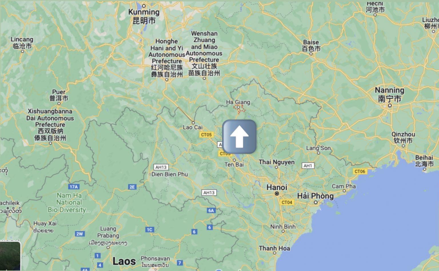
Ha Giang is located at the northernmost point of Vietnam, sharing a 270 km-long border with China. It is an important province of Vietnam and is composed of nine districts. Approximately 90% of the population in Ha Giang belongs to ethnic minorities.
It is best to divide the province into three regions for exploring its notable places.
Region 1: Hoang Su Phi and Xin Man – Extraordinary rice terraces in the rural areas of northeastern Vietnam.
While Sapa is undoubtedly the first place that comes to mind when thinking of rice fields in Vietnam, it is worth mentioning that there are breathtaking rice terraces beyond Sapa as well. Hoang Su Phi and Xin Man regions are less known to tourists, resulting in fewer visitors. If you are looking to explore regions beyond the popular tourist spots and witness the most beautiful rice terraces in Asia, we recommend spending at least three days in these two places, which offer stunning views for kilometers on end.
Region 2: The valleys and mountains between Quang Binh, Bac Quang, and Bac Me.
The region between Quang Binh, Bac Quang, Ha Giang, and Bac Me comprises mostly flat terrain with rice fields. It is known for its impressive scenery during sunrise and sunset. This area offers captivating views of valleys and mountains, making it an ideal location to witness the beauty of nature.
Region 3: The incredibly beautiful mountainous region in northern Ha Giang.
This region encompasses Quan Ba, Yen Minh, Dong Van, and Meo Vac, which are part of the famous Ha Giang Loop. It is known as the most popular area chosen by anyone planning a motorcycle route in Vietnam. The stunning landscapes of this region, characterized by mountains and breathtaking scenery, attract motorcycle enthusiasts from around the world.
This region, encompassing Quan Ba, Yen Minh, Dong Van, and Meo Vac, boasts incredible mountain vistas in the north. Known for the famous Ha Giang Loop, motorcyclists start their journey from Ha Giang and end it here as well. Allocating a minimum of 3 to a maximum of 6 days is sufficient for this loop.
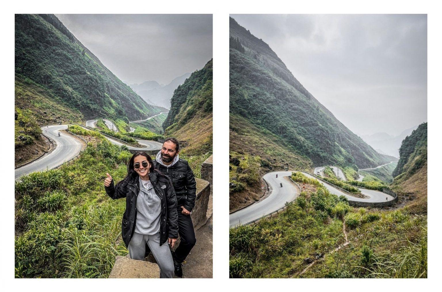
Ha Giang Loop
The complete loop is approximately 350 km long. However, if you plan to visit side roads, villages, waterfalls, and rivers, you will need to cover more than 350 km. It is essential to plan in advance how many kilometers you will cover during the day. For this purpose, it is crucial to consider the sunrise and sunset times in Ha Giang. We do not recommend riding after dark, as the roads are winding and the side roads can be unpaved, posing unnecessary risks. If you maintain a steady speed without rushing and do not take any breaks, you can cover approximately 100 km in about 3 hours. Based on this estimation, you can adjust the distance you plan to cover and allocate time for breaks according to your preferences.
Navigation is the most crucial application for this region. Before starting the route, make sure to download offline maps and pin the places you plan to visit in advance. If you create a route on the map, and let’s say the map estimates the duration as 1 hour, you must always multiply it by 2 or 3 to calculate the actual time. Navigation systems often underestimate the travel time.
How to get Ha Giang Permit
Before embarking on the Ha Giang route, it is essential to obtain a permit document from authorized agencies. This permit document serves as a type of travel permission or authorization throughout the Ha Giang route. It is essentially a driving permit. If you fail to obtain this travel permit, you may face significant fines if stopped at police checkpoints.
Ha Giang Routes
There are roads in Ha Giang that start with TL, DT, and QL. However, if you are planning a short visit to the Ha Giang route, we recommend staying on the QL road. QL is the national highway of the region, so the road conditions are generally better compared to DT and TL. Below are the roads you can use:
QL4C: This is the main road that runs through Ha Giang province, connecting Ha Giang city with other towns and districts.
TL176: This road takes you through the beautiful landscapes of the Ha Giang Loop, including Quan Ba, Yen Minh, Dong Van, and Meo Vac.
DT182: This road offers access to the Hoang Su Phi and Xin Man regions, known for their exceptional rice terraces.
QL.34
DT.176
When traveling in Ha Giang, it is important to familiarize yourself with these road codes and plan your route accordingly.
After determining the roads you will use, before starting your journey, do not neglect to confirm the road conditions with authorized tour companies or the company from which you will obtain the permit document.
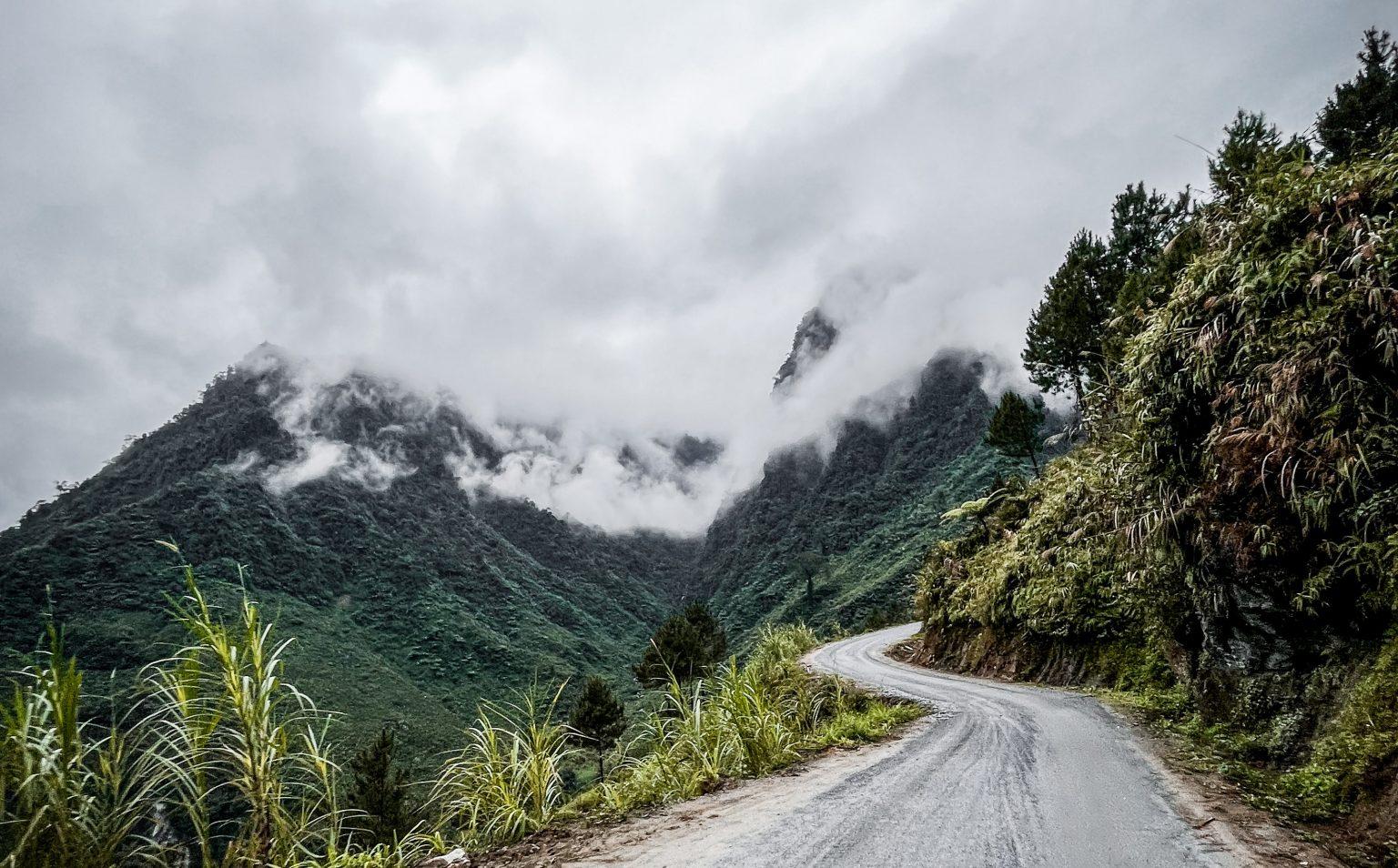
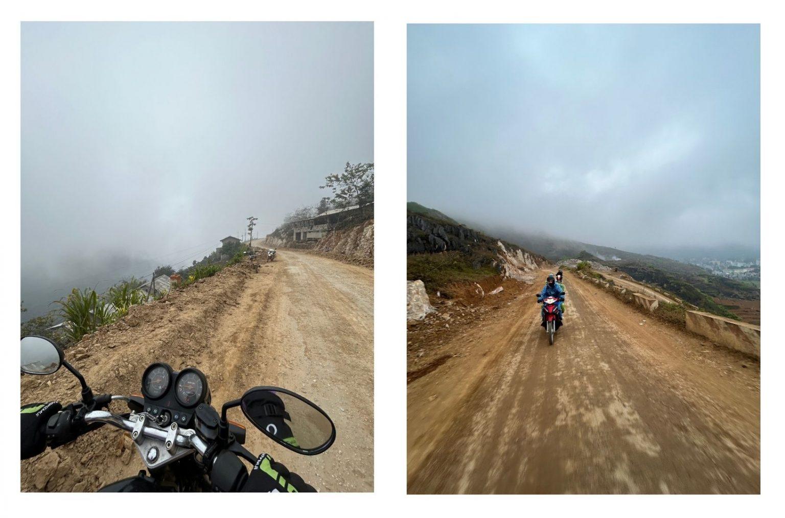
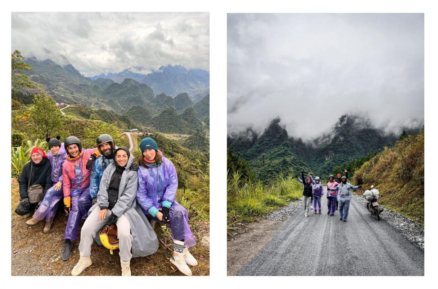
TL176 was the most challenging road we encountered along the route. It had both unpaved roads with large rocks and road construction in several sections.
176B, on the other hand, was the most enjoyable road we experienced along the route, immersing ourselves in a fairy-tale-like beauty. We hadn’t planned to take this road in advance. One of our friends didn’t know how to ride a motorcycle, so we had arranged a driver for them. The driver accompanied us throughout our Ha Giang journey, from waking up to going to bed. One day, as we were leaving the hotel and heading towards the predetermined route, the driver insisted, “No, that road is in bad condition; we should go this way instead.” We decided to listen to him, and we’re so glad we did.
Where to Stay in Ha Giang
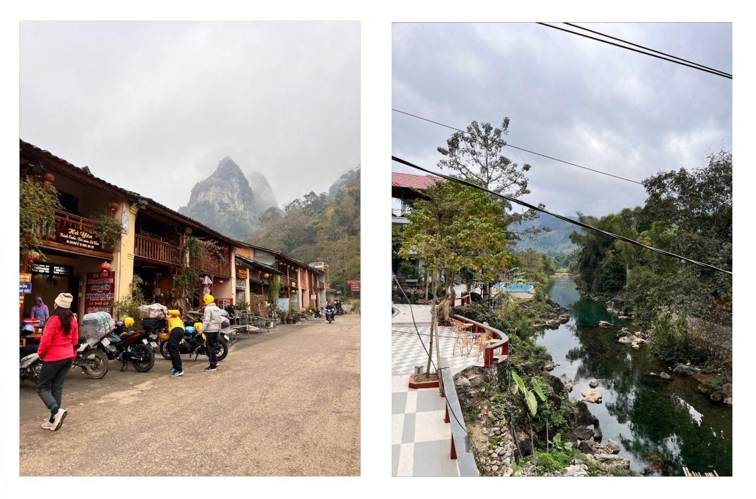
One of the main areas for accommodation along the Ha Giang route is Ha Giang city itself. Since the motorbike route starts and ends in this city, it is necessary to stay here on the first and last day of the journey. Other popular areas for accommodation, frequently chosen by motorcyclists, are Du Gia, Meo Vac, and Yen Minh.
You can leave booking your hotel until the last minute if you prefer. In each of the mentioned areas, there are accommodation options called “Homestays.” However, it’s important to note that Homestays may not offer the same level of comfort as hotels. Some Homestays are designed in a hotel-like concept, and you can search for these types of accommodations if you prefer.
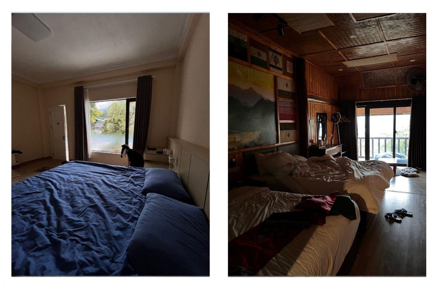
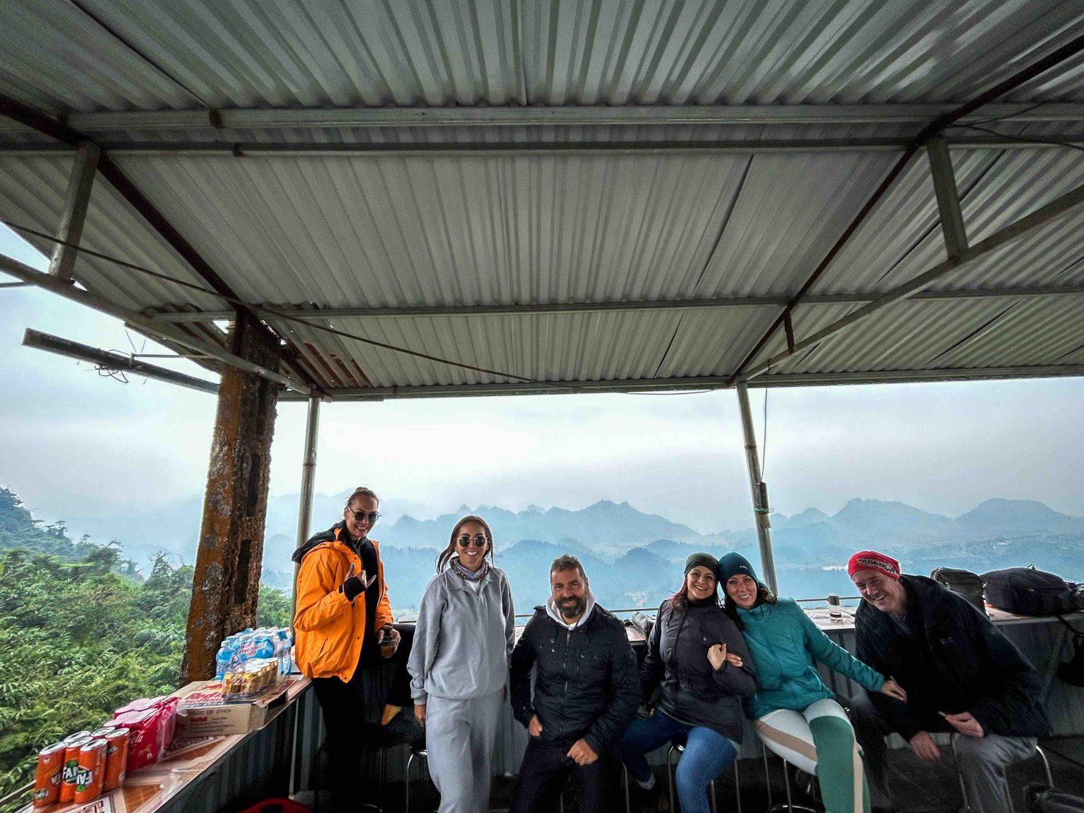
We stayed in Dong Van and Du Gia during our motorbike journey. The photos on the left show our hotel in Dong Van, while the ones on the right depict the exterior of our hotel in Du Gia.
However, if you plan to visit during the high season, it is crucial to make reservations for your accommodation in advance. Despite traveling during the low season, we couldn’t find availability at a stylish Homestay with a beautiful garden concept in Meo Vac. Based on our experience, once you determine your route, if accommodation is important to you, it is advisable to identify and book your accommodations in advance.
Ha Giang Best Things To Do – Ha Giang Travel Guide
-Quan Ba Heaven’s Gate
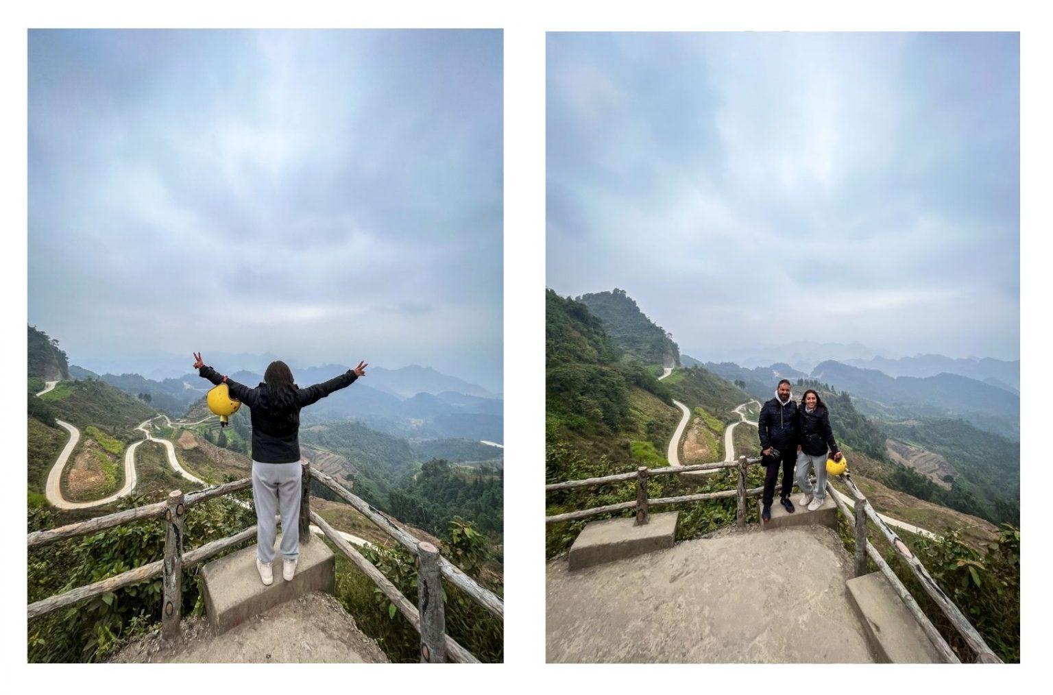
Known as the Quan Ba Pass or the Gateway to Heaven, Quan Ba is a must-visit tourist destination located 43 km from Ha Giang.
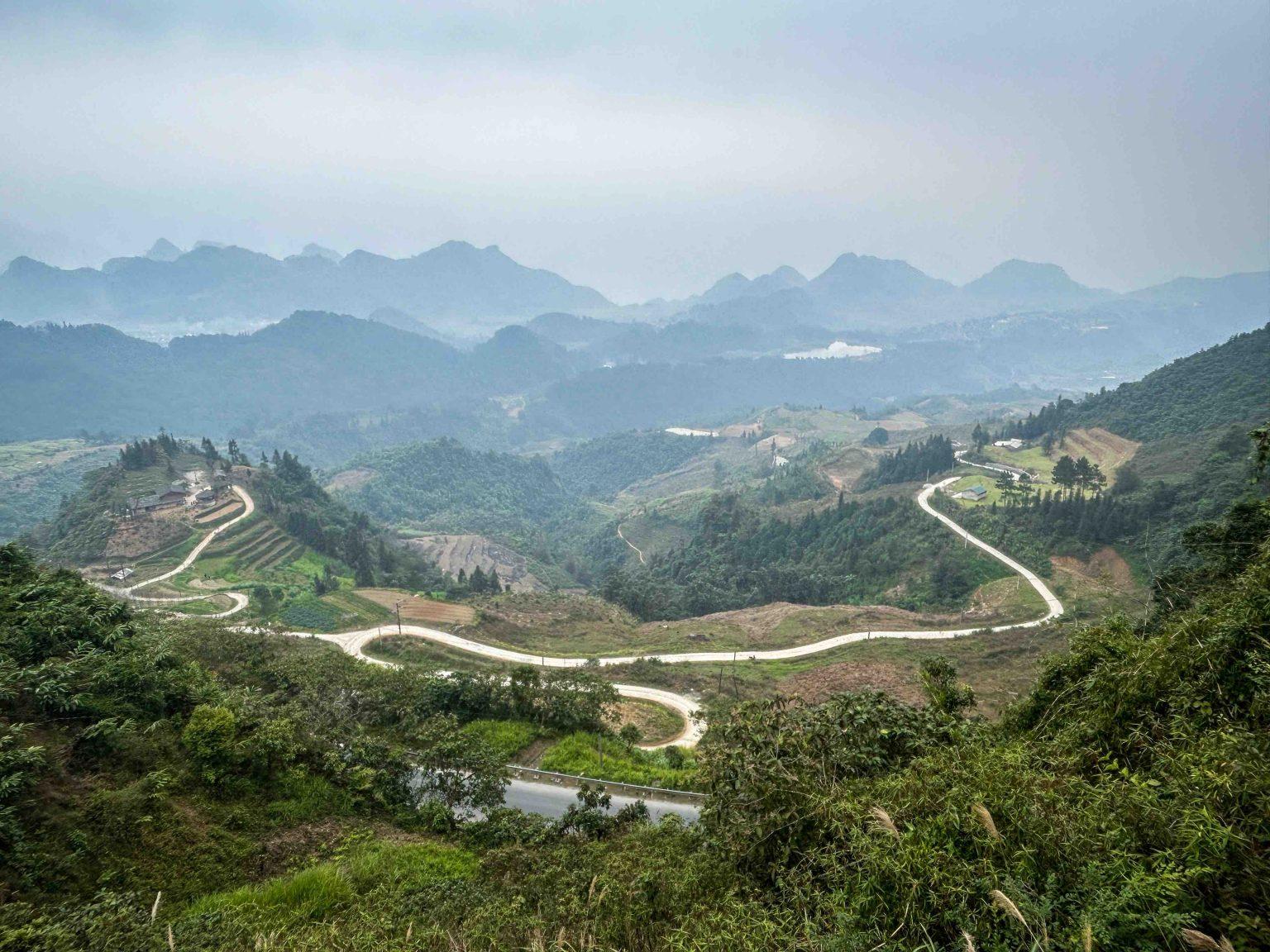
Situated at an altitude of 1500 meters above sea level, this pass serves as the gateway to the Dong Van Karst Plateau. The breathtaking scenery of the limestone mountains surrounded by clouds is truly enchanting. There are two viewing points where you can witness the same picturesque view as depicted in this photograph.
For the photo on the left, after paying a small entrance fee, you need to climb a few stairs. The location where the photo on the right was taken is along the road, and no entrance fee is required. The view from both places is truly stunning.
You can visit Lung Tam, the village of the Hmong people who live in the region. Here, the local people engage in traditional weaving and fabric dyeing, which are part of Vietnam’s ancient traditions.
In Tam Son, you can visit the market that takes place every Saturday, where ethnic minorities come to trade. The market is set up early in the morning and the crowds start to thin out around noon.
We do not recommend staying in this area for accommodation along the Ha Giang route.
-Yen Minh
Yen Minh is a small town located in a valley surrounded by mountains and rice fields, about 100 km east of Ha Giang. The town is situated right in the middle of the province’s highway, known as QL.4C. Motorcyclists often stop in Yen Minh to refuel, find accommodation, and satisfy their dining needs along the route.
One of the most beautiful places worth seeing in Yen Minh is Ngam La. We highly recommend visiting this area as it offers breathtaking mountain views. Additionally, don’t miss out on the nearby Na Dom Valley, which is known for its abundant rice fields. However, please note that to witness the vibrant green color of the rice fields in Na Dom, you need to visit during the right season. The best time to go is in September.
-Dong Van Global Karst Plateau
This region is a geopark, characterized by karst peaks scattered throughout. There are very few rice fields in this area. The presence of these mountains helps us understand why the Ha Giang region is relatively impoverished.
-Dong Van
Pho Bang Village: Located in the Dong Van region, Pho Bang Village is a must-visit place for photography enthusiasts and those seeking to experience different cultures. This peaceful mountain village is situated near the Chinese border and is home to ethnic minorities who migrated from China centuries ago. As you make your way to the village, you’ll be greeted by breathtaking landscapes. The houses in the village are made of adobe and supported by wooden columns, providing a cool environment in summer and warmth in winter.
On the way to Pho Bang Village, you can take a photo break at Sung Ta Intersection to capture the canola flowers. This spot is also where director Ngo Quang Khai filmed the movie “Pao’s Story.” In this Vietnamese film, you can get a closer look at the Hmong people. Interested individuals can search for the film “Pao’s Story” on Mubi to watch it.
The ideal time to visit the village is between April and October, particularly in the morning hours.
Dinh Vua Meo: also known as Vuong Palace, is a structure built in 1919 by King Meo (Vuong Chinh Duc), the leader of the Hmong people. It took 8 years to construct, and it served as the residence of the king.
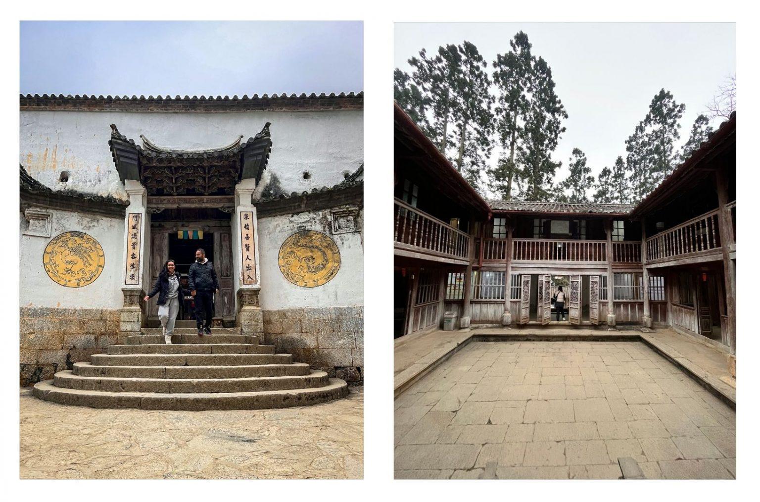
The structure, a fusion of Chinese, Hmong, and French architecture, features phoenix and dragon motifs, traditional Chinese calligraphy, and incorporates elements of feng shui. Surrounded by a wooded area, the mansion consists of three sections: the front, middle, and rear, and is a two-story wooden structure comprising 64 rooms. Be sure not to miss the columns shaped like poppy stones and the columns made of green stone with phoenix and dragon carvings.
Entrance Fee: 10.000 VND
Lung Cu Flag Point: Located just 20 km from Dong Van town in northern Vietnam, Lung Cu Flag Point offers a panoramic view of the Dong Van Plateau. To reach the point, you have to climb 283 stone steps. The tower, standing at a height of 33 meters, features reliefs at its base depicting the lives of ethnic minorities residing in the plateau. Additionally, the flag’s dimensions of 54 square meters represent the 54 ethnic groups living in the region.
Sitting at an elevation of 1,700 meters above sea level, it is the northernmost point of Vietnam.
Entrance Fee: 20.000 VND
-Tu San Canyon
Tu San Canyon, known as the deepest canyon in Southeast Asia, stretches 1.7 km in length and plunges 800 meters deep along the Nho Que River. Visitors have the option to admire the canyon from above, enjoying the panoramic view, or venture to the riverbank and rent a boat to cruise along the river.
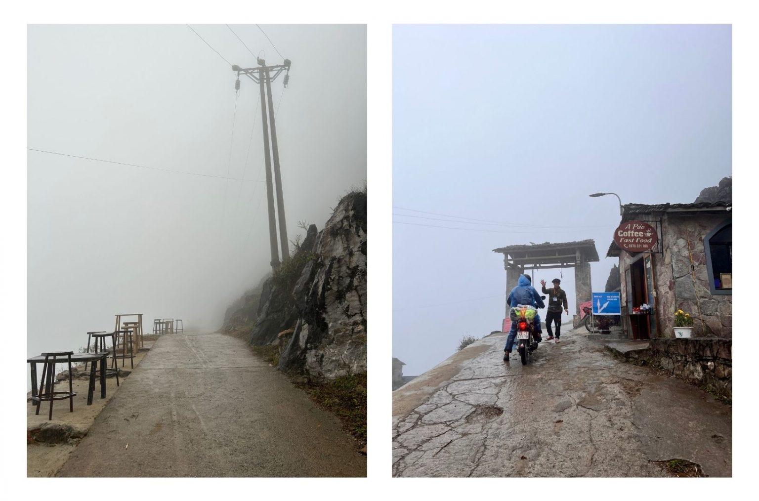
Unfortunately, during our passage through Tu San Canyon, we were unable to witness its beauty due to adverse weather conditions and heavy fog, which significantly limited our visibility.
-Ma Pi Leng Pass
Ma Pi Leng Pass, one of the most challenging mountain passes to cross in Vietnam, is also considered one of the country’s most breathtaking destinations. Stretching 20 km in length and situated at an elevation of 1200 meters above sea level, this pass is known for its narrow and winding roads. It took a total of 6 years, from 1959 to 1965, to complete its construction. Along the pass, travelers can enjoy panoramic views of the Tu San Canyon and the Nho Que River as they navigate through its twists and turns.
Unfortunately, due to poor weather conditions, we were unable to enter Ma Pi Leng Pass on the same day as it is located at the top of Tu San Canyon. Despite the foggy weather, we had decided to take the risk and proceed. However, the official at the entrance of the pass did not allow us to enter, and we were unable to cross Ma Pi Leng Pass.
Although it was disappointing not being able to experience the highlight of our Ha Giang Loop route, we left with the hope of visiting it on our next journey in Ha Giang.
-Tham Ma Pass
Tam Ma Pass is a delightful road that cuts through the middle of the mountains and consists of a total of 9 bends. At the very beginning of the pass, you can do some shopping from the local vendors’ stalls and take a short break to enjoy the scenery before continuing your journey.
Ethnic Minority Groups in Ha Giang
There are 16 different ethnic groups living in Ha Giang province. Among these ethnic groups, the largest one is the Hmong group. The second largest group is the Tay people, followed by the Kinh (Vietnamese), Nung, Dao, La Chi, Hoa, Lo Lo, Phu La, and Phu Peo.
The Hmong people, also known as the Highlanders, carry a distinct cultural element with their Mongolic accent. The word “Hmong” means “Free People”. With 2.5 million residing in China and 1 million in other countries, some Hmong people migrated to Vietnam, Laos, and Cambodia during the 19th century.
The Hmong people, while being the largest ethnic group in Ha Giang, are also the seventh largest ethnic group in Vietnam. The Hmong are further divided into several subgroups known as Flower Hmong, Black Hmong, and Green Hmong. For example, the Black Hmong women wear short black skirts and black leg warmers. They wear embroidered jackets that are fastened with a front belt. They adorn themselves with large silver necklaces and wrap a shawl around their heads.
On the other hand, Tay women wear black costumes and colorful belts. They wrap their hair with a black scarf.
The clothing of the Lolo people is the most colorful among other ethnic groups. They wear colorful skirts, intricately embroidered jackets, and hats with ribbons. The Lolo people mainly reside in Meo Vac and Dong Van. They are a subgroup of the Yi people living in China. In their own dialect, “Lo Lo” means “tiger” because they worship tigers.
Nung women wear garments with red embroidery and a red hat made of fabric and accessories.
Best Time To Go Ha Giang
December, January, and February: These months correspond to the cold winter season in the region. Considering that you will be riding a motorcycle, it is essential to pack winter clothing. Apart from the cold weather, another disadvantage during this time is the heavy rainfall and fog, which make the roads quite dangerous. The Ha Giang Loop is a winding route, and with rain and fog reducing visibility, it becomes particularly challenging.
March, April: During these months, the weather in the northern part of the country starts to gradually warm up as the spring season begins. However, it’s important to note that there is still a risk of rainfall.
May: If you prefer to avoid rain, mud, and fog, and if you don’t want to do the motorcycle route in winter clothing, May is the best month for the Ha Giang Loop.
June-September: This marks the summer season in Vietnam, with the hottest months. Nevertheless, it is still considered the best time for motorcycle riding on the Ha Giang Loop.
October-November: This period is characterized by dry weather and ideal temperatures.
When embarking on a motorcycle route, the most important factor for riders to enjoy their journey is the weather. It should be dry and around 20 degrees Celsius on average. Since you’ll be wearing protective gear while riding, sweating is possible if the weather is hot. Therefore, it’s crucial to choose the best time for your Ha Giang route by considering these factors.
We completed our Ha Giang route in the last week of December. As we mentioned, we had to do it during that time due to our Vietnam tour schedule. The weather was incredibly cold.